Mumbai and Thane are gearing up for a wet weekend as the India Meteorological Department (IMD) has issued weather alerts, forecasting heavy to very heavy rainfall, thunderstorms, and gusty winds for the region. The monsoon's revival is expected to bring intense weather across much of Maharashtra.
Both Mumbai and Thane will be under a yellow alert until Sunday, June 15th. However, the alert escalates to orange on Saturday, June 14th, with residents anticipating intense rainfall, thunderstorms, lightning, and strong wind gusts reaching 40-50 km/h.
The weather agency has issued a yellow alert for Mumbai on June 13, with a forecast of moderate rainfall accompanied by thunderstorms, lightning and gusty winds reaching speeds of 30 to 40 km per hour in isolated pockets. For June 15, the IMD has issued a yellow alert for Mumbai, with projections of thunderstorms, lightning and moderate rainfall alongside strong winds.
Thane district mirrors Mumbai's weather pattern. On June 13, some areas of the district will witness heavy to very heavy rainfall, with thunderstorms, lightning and strong winds. For June 14, there is an orange alert for Thane as well, with the IMD warning of heavy rainfall. By June 15, conditions may ease slightly with a yellow alert in place and forecasts of thunderstorms, lightning and moderate to heavy rainfall. Palghar will remain under a yellow alert across all three days — June 13 to 15 — with the IMD predicting light to moderate rain, thunderstorms with lightning and strong winds.
The heavy rain is expected to begin in the southern Konkan districts—Sindhudurg, Ratnagiri, Raigad—before advancing northward to Mumbai and Thane. A red alert has been issued for Ratnagiri district on Saturday, June 14th, indicating the possibility of extremely heavy downpours, violent storms, blazing lightning, and strong winds. An orange alert has been issued for the Raigad district on June 13 and 15, with expectations of heavy to very heavy rainfall and thunderstorms. On June 14, the alert has been upgraded to red, with the IMD predicting extremely heavy rainfall, thunderstorms and strong winds in some areas.
The weather conditions are attributed to an active upper air cyclonic circulation lying over north coastal Andhra Pradesh and adjoining south Odisha, along with a trough running from this circulation to coastal Karnataka. These systems are expected to bring heavy downpours to the region until at least June 17th.
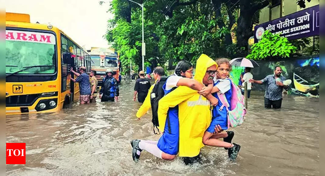
Residents should prepare for possible waterlogging, especially in low-lying neighborhoods, and expect traffic disruptions during peak downpours. Sudden thunderstorms could pose hazards to outdoor activities, so precautions such as carrying umbrellas and avoiding coastal strolls during high winds are advised. Fishermen have also been warned to avoid venturing out due to deteriorating sea conditions across the four-day forecast period.
While the absence of strong weather systems led to a lull in showers and a spike in daytime temperatures recently, the monsoon is now reviving, promising a significant increase in rainfall activity over the coming days.