The world's most expensive Earth-imaging satellite, the NASA-ISRO Synthetic Aperture Radar (NISAR), is scheduled to launch on July 30, 2025, at 17:40 IST from the Satish Dhawan Space Centre in Sriharikota. This joint mission between the Indian Space Research Organisation (ISRO) and the U.S. National Aeronautics and Space Administration (NASA) marks a significant milestone in international collaboration in space science and Earth observation.
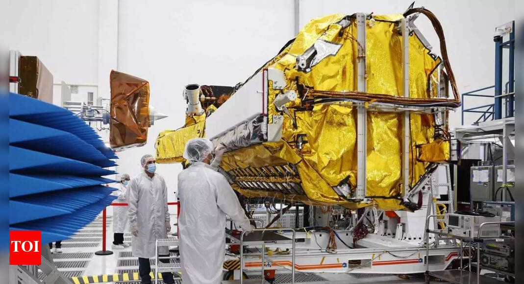
NISAR is the first satellite to observe Earth with a dual-frequency Synthetic Aperture Radar (SAR), utilizing NASA's L-band and ISRO's S-band. This unique capability allows it to penetrate clouds and vegetation, providing high-resolution data day and night, regardless of weather conditions. The satellite will use a 12-meter deployable mesh antenna, supplied by Astro Aerospace, and integrated with ISRO's modified I3K satellite bus.
The satellite, weighing 2,392 kg, will be launched aboard ISRO's GSLV-F16 rocket into a 743 km sun-synchronous orbit. The mission is designed to map the globe every 12 days, providing spatially and temporally consistent data. NISAR will employ SweepSAR technology to achieve a wide swath of 242 km with high spatial resolution.
NISAR's primary objective is to observe and measure Earth's most complex natural processes, including ecosystem disturbances, ice-sheet collapse, and natural hazards such as earthquakes, tsunamis, volcanoes, and landslides. The satellite can detect even small changes in the Earth's surface, such as ground deformation, ice sheet movement, and vegetation dynamics. Data from NISAR will be made freely available within one to two days after observation, and within hours in case of emergencies like natural disasters.
The mission is the result of over a decade of collaboration between ISRO and NASA's Jet Propulsion Laboratory (JPL). ISRO is providing the satellite bus, an S-band synthetic aperture radar (SAR), the launch vehicle, and associated launch services. NASA is providing the L-band SAR, a deployable boom, a high-rate communication subsystem, GPS receivers, a solid-state recorder, and a payload data subsystem. The S-band SAR was developed at ISRO’s Space Applications Centre in Ahmedabad, while JPL built the L-band radar in Southern California.
With a total cost estimated at US$1.5 billion, NISAR is likely the world's most expensive Earth-imaging satellite. ISRO's share of the project cost is about ₹788 crore (US$93 million), and NASA's share is about US$1,118 million. The high cost is attributed to its advanced technology, including the large deployable antenna and the integration of two complex radar systems.
NISAR's data will have a wide range of applications, including:
The NISAR mission is expected to provide unprecedented insights into climate change, natural hazards, and Earth's dynamic ecosystems. The data will empower scientists, policymakers, and communities to make informed decisions and develop effective strategies for a sustainable future.